Backpacking the Ridgeway (4) – the Eastern Half, Day 3

White Mark Farm, where the very serviceable campsite was located, takes its name from the neighbouring landmark of Watlington Hill, whose eponymous white mark was apparently cut into the hill by a local vicar who wanted to make the spire of his church appear taller than it actually was. As I did not get to view either the mark or the church, I am unable to vouch for whether this clerical landscape artifice had the desired effect or not.

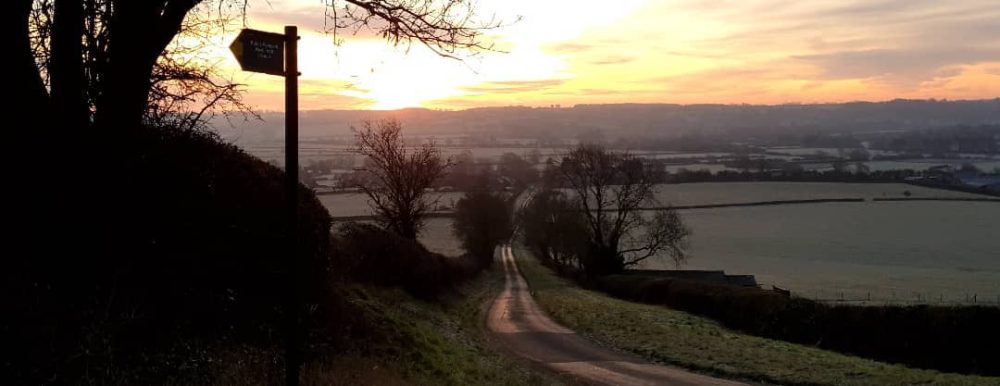
The first few miles of the day continued along the disused railway line until the Ridgeway decided it was time to strike off across country and climb up and down some more rolling hills, mainly through arable farmland with some small woods adorning the hilltops. The first stop of the day was at St Botolph’s Church, Swyncombe, a building of Anglo Saxon origin dedicated to a Benedictine monk from East Anglia who died in 680AD. The best really old churches have a deep feeling of peace about them, and this was one of those, a feeling no doubt helped by the fact that the hamlet of Swyncombe seemed to epitomise the term ‘sleepy’.

Physically and spiritually refreshed, it was time to hoist the rucksack onto what were now becoming quite tight and sore shoulders and coax stiffening legs back into action. Part-way through the third day, the fact that I had not undertaken any preparatory training for this walk other than a few extended rambles with the dog, none of which had involved carrying weight, was beginning to catch up with me. Things would get worse later that day.

More rolling farmland and more beechwoods – this was pleasant enough walking but I couldn’t help but view these first few days as a warm-up for the more remote miles that lay ahead on the second half of the walk. The first three days strengthened my feeling that I had been right to tackle the Ridgeway ‘backwards’ from East to West and to travel from the neatly ordered countryside of Buckinghamshire towards the more sparsely populated parts of Berkshire, Oxfordshire and Wiltshire, littered with echoes of their ancient former inhabitants. Before long the route crossed that pinnacle of neat ordering of the countryside: a golf course.

Having safely negotiated the crossing of Huntercombe Golf Club’s premises without falling victim to any wayward tee shots, I arrived in Nuffield on the trail of one of the excellent water points dotted along the length of the Ridgeway. The tap in question was attached to the wall of the parish church and I thankfully refilled my bottles, resisting the temptation of the tea and cakes on offer inside the church.

From Nuffield, the Ridgeway makes a 90-degree turn to the west and follows the line of  Grim’s Ditch, an extensive Iron Age earthwork of unknown function that is one of a number of similar features sharing this name located across the chalk uplands of southern England. It was near the beginning of the Ditch that I encountered the only other person I  was to meet during the course of the walk who was travelling the entire length of the Ridgeway: a fellow wild camper who was walking from West to East. We stopped briefly to compare notes and exchange tales of the trail.

It was at this point that my back really started to complain with painful muscle cramps that reduced me to walking in 20-minute bursts, interspersed with frequent stops to try to stretch my way to some relief. It became clear that I was going to have to do something about this or the expedition could end up being aborted short of the halfway point. Looking at the map, it seemed that the town of Wallingford, located a mile or so off the trail at the other end of Grim’s ditch was the best bet to contain somewhere I could score some industrial strength pain relief.

I did not make a note of how long it took me to get to the end of the Ditch at Mongewell Park, but those three or four miles seemed to take forever until I was able to cache the rucksack in the bushes at the point where the Ridgeway made a right-angle turn to the south, and head towards Wallingford on an alternative footpath.

Once in town, I had two missions: the quest for pain relief led me to Boots where a helpful pharmacy assistant, once she had been assured that Ibuprofen was not the answer (“how much are you taking?”, “British Army dose: 800mg, would kill a civilian but it’s not touching it”) kitted me out with some Co-codamol. Having washed these down with a cup of coffee, a pasty and a bun in Greggs, it was time to tackle the second mission and find somewhere that could sort out the power bank I had brought along for my phone and which did not seem to be offering any power, despite being fully charged.

If you ever bemoan the fact that mobile phone shops are taking over our town centres in unparalleled numbers, I can recommend a trip to Wallingford, which appears to be the only market town in southern Britain that does not share this blight of modern living. Ordinarily, I would rejoice in the fact that the good people and small traders of Wallingford had resisted this particular scourge, but on this occasion I could really have done with a Vodafone or EE shop, a Carphone Warehouse or a Phones4U, all of which seem to appear in every high street in every town in the land. But not in Wallingford they don’t. There was, however, a rumour of a little shop that sold secondhand video games and fixed phones. Unfortunately nobody seemed certain of the exact location of this underground technology emporium so I had to do several more laps of Wallingford town centre until I tracked it down. It is embarrassing to report that the issue with the power bank was my failure to operate the on/off switch. However, I feel vindicated by the fact that it took the phone repair man a good 10 minutes to find it, so well was it camouflaged.

Wallingford blackboard

But no phone shops

With the drugs starting to take effect, it was time to retrieve my pack from the hedge where I had dumped it and attempt to make up some lost time.

Having got over its ‘up and down every hill in the Chilterns’ phase, the Ridgeway now proceeded to wander sedately along by the Thames in a very pleasant fashion.

I soon realised that I was not going to make it through the conjoined towns of Goring and Streatley and out into the open countryside before nightfall and so decided that what my back really needed was a proper bed for the night.

As dusk fell I plodded into the metropolis of Goring-on-Thames in search of a suitable place to lay my weary head, and ideally a couple of pints and a bite to eat as well.

The Miller of Mansfield struck me as an unlikely name for a pub in this genteel part of Oxfordshire but I crossed the threshold and enquired after the possibility of a room, reassuring the receptionist that I was both able to foot the bill and less disreputable than I appeared. She very helpfully moved a few bookings around to accommodate me and I decided to quit while I was ahead by declining her hesitant offer of a table in their very smart restaurant and reassured her that I would be quite happy to eat in the bar but that I would have a shower and make myself presentable first, so as not to upset their very smart South Oxfordshire clientele. Not for the last time, it struck me that it was possible to get away with looking like a tramp in these parts so long as one talked posh and it was to be a recurring source of amusement to watch people view my approach with a certain amount of trepidation or disdain, only to visibly relax when it turned out that the tramp spoke just like they did.

Having polished off the “Selection of Home Cured Meats & Pâté, Smoked Cheese, Pickled Onions, Gherkins & Malt Bread (large) washed down with a couple of pints to help the Co-codamol work its magic, it was time for bed.

Backpacking the Ridgeway (3) – the Eastern Half Day 2

Image

The feeling of life being good wore off a little as I discovered just how uneven my chosen bivi site actually was and I had to wedge myself into all sorts of strange, contorted positions in order to stay in my position on what had turned out to be the side of a hill, or so it felt.

Nothing seems to last as long as a bad night in a sleeping bag but eventually the sky lightened and Day 2 dawned – and a very misty dawn it was too.

Morning day 2

Morning, Day 2

As it was 6am, it was time to get up and, rather than have breakfast where I was, I decided to continue to the top of Bacombe Hill – except there isn’t such a place: for some reason not explained on the map or in the guidebook it becomes Coombe Hill near the top – and have breakfast there, taking in the magnificent views, which the mist would reveal to me by helpfully lifting at the appropriate moment.

It would not be quite accurate to say that I sprinted up the first hill of the day but that morning probably saw the fastest start to any day of the walk: I was going to get a lot slower over the course of the next five days. I arrived at the top of Coombe Hill in short order and almost tripped over a monument…

Coombe monument

Wikipedia says “Coombe Hill Monument is one of the first and largest examples of a war memorial erected to honour the names of individual men who fell whilst fighting for their country. The monument is an iconic Buckinghamshire landmark and a Grade II Listed monument.” It is certainly impressively large and quite imposing when it suddenly appears out of the mist.

When packing for the walk I had allocated a pot of instant porridge for breakfast each morning apart from the first day, which would be marked by Spam, likewise the last day, for which purpose I would carry a second tin for another 70 miles or so.

Spam served cold is unappealing stuff but, when sliced and fried, it is truly the breakfast of champions. I tucked in, after explaining to two curious Buckinghamshire Labradors who appeared at that moment, accessorised with Puffa-jacketed Buckinghamshire yummy mummies, that any attempt to share this ambrosia of the gods would be met with strenuous resistance at the point of a lightweight camping fork.

The mist having failed to part on schedule, I set off down the hill without the benefit of the promised magnificent views. At the bottom of Coombe Hill lies Chequers, the grace and favour country estate of the UK Prime Minister. Casual visitors are not encouraged to pop in.

Chequers sign

There was something about the row of “Trespass on this site is a criminal offence” signs and cameras either side of the point where the Ridgeway crosses the front drive of Chequers that made me quicken my pace. Once at the top of the shallow slope leading away from the gates, I struck a blow for the revolution by stopping for a pee up against one of the Prime Minister’s trees.

Having left Chequers behind, the Ridgeway proceeds to breach the Trade Descriptions Act by insisting on proceeding up and down every available hill in this part of the Chilterns before descending from the high ground to skirt around the outer parts of Princes Risborough.

By early afternoon, I felt I had broken the back of the day’s walking and, seeing as the September sunshine had led me to work up quite a thirst, an off-trail detour for a pub stop was called for. A quick map appreciation (as the Army calls it) revealed that the best place for this would be the village of Chinnor and a quick Google appreciation (as the Army might possibly call it now but certainly didn’t in my day) flagged up The Crown Inn as the target pub.

Chinnor pub stop

When I ran the tourism team at the Brecon Beacons National Park, we used to despair of the thousands of walkers who flocked to the area each year to erode the peaks but contribute nothing to the local economy, and so ever since then I have felt that I have a moral duty to right this wrong by stopping at pubs when out for a walk.

Moral duty done, I strapped the pack back on for a few miles of boring road walking before rejoining the Ridgeway, which by now was following a disused railway line that I am pretty sure wasn’t part of the original Neolithic route. After a couple of miles, the trail took an underpass under the M40 motorway where this slices through the Aston Rownant National Nature Reserve adding, may I say, not a great deal to the natural beauty of the area as it does so. At this point it became clear that my slightly over-optimistic estimate of how leisurely the aforementioned pub stop could be meant that it would be a race against time to get to that night’s campsite at Watlington before darkness fell.

It was a race that I was not to win and I arrived at White Mark Farm  and its campsite, situated no more than 200 metres from the trail, by the light of my head-torch. The decision to stay on a formal campsite rather than to wild camp was one that was again based on wanting to contribute something to the local economy in exchange for my use of their scenery. There are not many campsites within easy striking distance of the Ridgeway, so it seemed churlish not to put some business the way of the most convenient one. A hot shower, another boil-in-the bag dinner and it was time to settle down for what would hopefully be a better night’s sleep; at least this time there was no questioning the flatness of the pitch.


Backpacking the Ridgeway (2) – The Eastern Half – Day 1

Most people, it seems, walk the Ridgeway from West to East and that is how the official Ridgeway National Trail guide book is written, so naturally I decided to do the walk ‘backwards’ from East to West. This was not entirely out of sheer perversity: I quite liked the idea of walking away from civilisation to arrive at Avebury and its stone circle on the Autumn Equinox, so the walk took on something of a pilgrimage-like quality. Doing the route this way also meant that Nicola could pick me up at the end and we could spend the weekend with our daughter in Salisbury before travelling on to see eldest son in Plymouth by way of a gentle few days’ touring Dorset and Devon.

Anyway, before any of that there were 90 or so miles (it is very hard to find a definitive figure) of Ridgeway to be walked and Avebury seemed a long way away as Nicola and her friend Julia set me down in the layby on the B489 at the foot of the first hill.

I don’t like walks that start with a steep climb and prefer a few gentle miles for heart, lungs and legs to get into the swing of things, feet to settle into boots and final adjustments to be made to rucksack straps before tackling the first hill. Still, since the official start line of Ivinghoe Beacon was at the top of this hill, the only way was up. One sharp 240-foot climb later, I was across the start line and officially walking the Ridgeway.

The beauty of backpacking a multi-day walk with a view to wild camping rather than using camp sites or other accommodation is that you are free to stop wherever the mood takes you and a suitable patch of ground presents itself. In practice I always find that I have a deadline by which I have to complete the walk and this means that, in order to meet this deadline, there is a more or less strict schedule for every day of the walk in order to avoid the situation of having to make up extra miles on tired legs on the final day or two.

Sign day 1

The target for the end of the first day was to be Wendover with a view to finding an overnight bivi site on the inviting (on the map anyway) open but wooded ground of Bacombe Hill.

The route soon entered what was to become a very familiar landscape of chalk grassland and Beech woods typical of the Chilterns countryside and, to the eyes of one more accustomed to the acid soils and Oak woodland of Charnwood Forest, a landscape full of unfamilar plants in unaccustomed cololurs – all the flowers seemed to be shades of purple.

The first day was, in view of the fact that I didn’t get going until 1pm or so, scheduled to be a short day – 12 miles instead of the average daily mileage of 17 or so planned for the next four days. At the time of the Autumn Equinox the sun rises around 7am and sets twelve hours later so I had six hours in which to complete the day’s allotted mileage and find a suitable place to spend the night before sunset: not a blisteringly fast pace but not too much time to stand and stare either.

After a pleasant afternoon of trying to relax into the rhythm of the walk – which always takes a while – and enjoying the views over the Hertfordshire and Buckinghamshire countryside (the Ridgeway, being mostly on the ridge, is good for big landscapes), I negotiated my way through the town of Wendover and found myself at the foot of Bacombe Hill: time to look for somewhere to bed down for the night.

Having done all of my previous wild camping on the open moorland of places like Dartmoor and the Brecon Beacons, I was a little wary of camping wild in the lowlands so close to settlements. Certainly that first evening I prioritised discretion at the expense of comfort and spent an uncomfortable night in an extremely discreet, well camouflaged  location amid the thorn scrub on the lower  slopes of Bacombe Hill.

Basha night 1

The beauty of camping on the trail rather than having to divert to find overnight accommodation is that you don’t have to walk wasted miles at the beginning and end of the day and the beauty of using a tarp rather than a tent, apart from the saving in weight, is that you can pitch it in no time at all.

So, in no time at all, the basha was pitched and dinner was cooking; the first night’s fare being boil in the bag vegetable chilli from the MoD’s range of culinary classics – a cheeky little 2004 vintage that I found at the bottom of a box. Still perfectly edible so I dread to think what preservatives it contained.

Quite often the only way to find out if a site is level or not is to get into a sleeping bag, at which point the ground which looked “flattish, it’ll do” when pitching starts to feel like it is on a 45-degree slope but it is now dark and too late to do anything about it. Still, I was outdoors in a warm sleeping bag with a full stomach and the first day’s walking behind me and life was good.

Backpacking the Ridgeway September 2017 (1)

Image

The Ridgeway is an 85-mile long trail that follows the chalk ridge from Ivinghoe Beacon in Hertfordshire, through parts of Berkshire and South Oxfordshire before finishing at Avebury in Wiltshire. It follows ancient trade and drove routes and is reputedly the oldest road in England, if not the whole of Europe. As befits this status, it passes through landscapes that are punctuated by relics of our Neolithic and Bronze Age past including many barrows and hill forts. The Ridgeway is designated as a National Trail and I first came up with the idea of backpacking it several years ago, encouraged by a half-day spent walking the Oxfordshire section once when Nicola was visiting a friend in Didcot. This year, following a particularly trying period at work, I booked two weeks off at the end of September with the idea that I would spend the first week doing the walk and then we would spend the second week touring the West Country via two of our children in Salisbury and Plymouth.Guide book

Planning and Preparation

Having decided that I would aim to wild camp on at least some of the five nights I would be on the trail, I turned to Google to see what advice the internet had to offer as regards the feasibility of this approach. As the general gist of the accumulated wisdom of the worldwide web was “go for it”, the next step was to assemble some suitable kit.

Previous experience of labouring up and down hills carrying heavy weights had taught me that, in view of my advancing years and lack of training, less would definitely be more when it came to putting together a kit list. I reasoned that, as this would be a lowland walk in autumn as opposed to a mountain walk in winter, I could cut a few corners in the interests of keeping the pack weight down, the first of which would be to manage without a tent and instead bivvy using a tarp shelter pitched on the walking poles to which, after years of mocking other walkers who used them, I had become a committed convert. I borrowed a 3m x 3m DD tarp from Son #2 who uses it with a hammock, so it came complete with generous lengths of para cord attached to each corner. This, together an unmatching pair of cheap walking poles and a handful of tent pegs, would do for accommodation. The beauty of this approach is that, instead of having to be carried all day, the “tent poles” are in productive use 24 hours a day and the rest of the “tent” weighs less than 1kg.

Having decided that my 35-litre daysack would enforce a bit too much frugality for a 5-6 day trip and that my 85-litre Army bergan would be overkill, my rucksack of choice was a 60-litre budget Eurohike number left over from the kids’ DofE days. Continuing the low-budget theme, cooking equipment was a basic screw-on gas burner purchased from an army surplus store 15 years ago, a couple of gas canisters, a pair of cheap mess tins from Go Outdoors, plastic KFS set, plastic bowl and trusty old British Army plastic mug.

Sleeping bag was a Vango 2-season lightweight down number teamed with a full-length Thermarest mat and lightweight groundsheet.

In terms of food, I decided to allow for a couple of pub or chip shop stops when passing through civilisation and to carry sufficient food for the rest of the trip. I discovered I still had a couple of meals’ worth of MOD-issue “boil-in-the-bag” rations left over from previous expeditions and a trip to Go Outdoors for more “boil-in-the-bag” meals and to the local Co-op for instant porridge sachets, cereal bars, tea bags and hot chocolate powder completed the catering procurement, apart from a couple of tins of Spam to be fried when needed to provide the ultimate morale-boosting breakfast indulgence when on the trail.

Water is an issue on the Ridgeway which, as the name suggests, follows the chalk ridge and is therefore above the springline: naturally occurring water sources are therefore all but non-existent. Fortunately the good people at the Countryside Commission (as was) National Trails Office foresaw this problem and have arranged with farmers to provide occasional water points along the route. These are marked on the excellent Ridgeway National Trail Map produced by Harvey Maps and I had no trouble in locating any of the ones that I looked for and all were in working order. Based on an estimated water consumption of 2 litres per day, I decided that carrying 1.5 days’ worth i.e. 3 litres, would be sufficient. In the event, I could have managed with less but I prefer to err on the side of caution when it comes to water, even if it means carrying a bit more weight. Obviously, doing the walk in hot weather or using dehydrated rations will increase water requirements.

Total all-up weight of the pack, including food and water, was a little under 40lbs.


Up to Town

At 5.10am the alarm clocked jarred its way into my consciousness and reminded me that today was one of those rare days that I had to turn my back on the rural idyll of Bradgate Park and join the (less than) happy band of commuters standing on the platform at Leicester station prior to travelling up to The Big Smoke for the day.

It is difficult to find a much greater sense of dislocation that the one I started my day with: at 6am I was driving through a silent and deserted medieval deer park and at 8am I was crammed onto an Underground train that bore more than a passing resemblance to a cattle truck. Thankfully only two stops on the Northern Line before walking up and down the City Road (it should only have been down but the culture shock seemed to throw my usually good sense of direction out of kilter) on my way to my destination in EC2A.

I always joke that I like to commute to London once or twice each year as it makes me appreciate how good my life here is. Once again I have made the point to myself and I am safely back at home feeling suitably appreciative of my rural existence. On the trip home I tried to calculate just how much an employer would have to offer me to induce me to put myself through the commuting experience twice a day, every day. Suffice to say, the sum involve is sufficiently large that the chances of my ever being lured away to the bright lights and gold-paved streets are, to all intents and purposes, non-existent.

In the words of Ricky Scaggs: “I’m just a country boy at heart.”

Back in the Beacons (2)

I have been walking in the Brecon Beacons since the early 1990s and, now that we no longer live halfway up a mountain, a trip to see friends in the area is not complete without at least one decent length walk involving a significant hill.

Despite the erosion, the crowds and the sheer familiarity of the area around Pen y Fan, the highest peak in southern Britain, still exerts a magnetic pull. I have climbed ‘The Fan’ in sun, rain, snow and gale force winds, in uniform and in civilian clothes, carrying big weights and no weight, on a tight schedule and with all the time in the world to stand and stare. I have friends for whom Snowdon or Kinder Scout are their spiritual hilltop homes: for me it’s Pen y Fan.

On this occasion I had the chance to be dropped off anywhere along the A470 as Nicola was off to Cardiff for the day, which saved me the perennial hillwalker’s dilemma over where to leave the car and gave me the rare opportunity to take a route up into the Central Beacons that I had not walked before. After that it would be over the top and down the other side by any number of possible routes, depending on the weather and how many miles were left in the legs, to get back to the caravan site at Brynich.

The first mile or so from the roadside to the hill gate was a steady uphill plod through an unremarkable conifer plantation but with the familiar sense of anticipation as the road fell away below and the big skies beckoned.

At the hill gate looking up

So many of the routes in the Central Beacons are either badly eroded scars or have been repaired so as to be paved highways so the prospect of picking a route up the shoulder of Cefn Crew without an obvious path to follow was a refreshing one.

The Beacons, in common with most of the upland areas of Britain, have been so heavily grazed by sheep for so many years that until 2001 little vegetation survived other than close-cropped grass and the ubiquitous and inedible bracken pursuing its relentless march across hillsides where the natural process of succession to scrub and woodland that would shade out the fern were held in check by the heavily subsidised ‘woolly maggots’.

What changed in 2001 was the outbreak of Foot & Mouth Disease. As the infection spread across the country, aided and abetted by the practice of transporting livestock for hundreds of miles by road often as a result of the closure of local markets and abattoirs, ironically caused by the imposition of new food safety standards. As a result, the night skies in these parts of rural Wales were lit up by the flames from enormous funeral pyres as the carcasses of tens of thousands of sheep and cattle, killed not by the disease but by the cull that was imposed by the government in an attempt to halt its spread, were burned .

Tormentil and bilberry -signs of reduced grazing pressure

Although the government compensated farmers for their losses, some were so traumatised by the experience of the pyres that they retired from farming altogether. Others took the opportunity of the enforced conversion of their livestock into cash to restructure their farm businesses and diversify. Either way, the numbers of sheep grazing the hills were decimated and did not recover to their pre-2001 levels. In ecological terms, this is the best thing to happen to these mountains in many a long year, although as a result of the predominance of farmers among the membership of National Park Authorities and the pressure on National Park staff to never or say or do anything that might be construed as being critical of the farming lobby, this is a truth that no-one dare speak.

As I continued up towards Blaen Crew and the first of several false summits, the air was full of the song of skylarks and the occasional screech of a buzzard or red kite soaring overhead. The red kite has been one of the great success stories of recent reintroductions of previously native species that had been driven to extinction in the UK by the hand of man, in this case by gamekeepers on sporting estate seeking to stop these raptors taking game bird chicks. When I first lived in Wales, red kites were still so rare that the Army mounted a round-the-clock guard of known nesting sites in Mid Wales. Twenty years later we can see these wonderful birds in the skies over Leicestershire.

View from the summit of Pen y Fan with Cribyn in the foreground

View from the summit of Pen y Fan with Cribyn in the foreground

Cresting the ridge, I followed the well-worn path around to Bwlch Du Wynt – ‘Pass of the Dark Wind’ – where the wind really does hit you on a winter’s day, but on this occasion the sun was shining and the air was still. From here, the path joins the tourist motorway coming up from Pont ar Daf car park – the shortest, easiest and dullest route up Pen y Fan. I skirted around Corn Du and, after the short final pull up to the top, I was once again standing on the summit of South Wales’ highest mountain, standing a few tantalising feet short of the magical 3,000 foot mark. Avoiding the excited family group posing with a Union Jack on the summit cairn, I took a moment to recall some of the previous times I had stood in this place – with old and bold paratroopers recounting tales of the ‘Fan Dance’, part of SAS Selection and the time I had a soldier collapse with exhaustion and hypothermia and the quickest way to get him off the hill was to kick him over the top and down the other side to the shelter of Cwm Gwdi Training Camp, now long since demolished and the site returned to nature. I have trudged up that hill with 40lbs on my back dripping with sweat despite the freezing fog and have run up it on a summer’s day in T-shirt and fell shoes. This time, thinking about everything that has happened since I last climbed The Fan the over-riding feeling was “I’m back and I’m still alive”.

Windy Gap, on this occasion without the wind

Windy Gap, on this occasion without the wind

The problem with climbing mountains is that sooner or later you have to go back down again. The words of Alfred Wainwright “you may not pass this way again” are always in my mind whenever I turn my back on the view from any summit and start the downward, homeward trek. Picking my way over the scree, my knees and thigh muscles wasted no time in informing me that they were not getting any younger and that, after seven years living back in the lowlands of the East Midlands, Cribyn on this occasion would be a hill too far. I heeded their advice and bypassed the next peak to arrive at the pass where the old Gap Road crosses between Cribyn and Fan y Big. I always think of Windy Gap as a place to shelter briefly from a gale or driving rain and take on some high-calorie sustenance before once again braving the elements to tackle the next summit. I have never before had to seek shade from the relentless sunshine and strongly suspect  this to be a once-in-a-lifetime experience that will never be repeated.

Off the hill and back below the tree line

Off the hill and back below the tree line

All that now remained was to negotiate the loose, stony surface of the Gap Road- painful on tired legs – and to trudge the final few hot tarmac miles back down to the real world.

Back in the Beacons

caravan

Our little tin box on wheels

At the end of July we took the caravan to Brecon for a week to revisit some old haunts and catch up with old friends. Now I have to admit to having changed my opinion of caravans over the past couple of years. Whereas my views previously verged on the Clarksonesque, I do have to admit that our little tin box on wheels offers many advantages over our previous portable holiday accommodation of choice, the trailer tent. For a start the bed is a lot more comfortable, especially on this trip as, following an unfortunate incident where one of the cats got locked in the caravan a few days before we left home, the tin box’s sofa/bed cushions were unusable so we took the mattress off our bed instead. The other great improvement is that, instead of spending the best part of an hour wrestling with poles and canvas, usually in a howling gale or driving rain, arriving on site involves driving in, unhitching the caravan from the car, winding down the four legs and putting the kettle on. Caravanning is not sexy, it’s not cool and it’s not glamorous but then neither am I and, what is more, I have got to an age where comfort is becoming an increasingly appealing alternative to all the above.

The main aim of this trip was to catch up with old friends and that started with our choice of base for the week. In 2004, when I first started work at the Brecon Beacons National Park Authority, I lived for two months in a cottage at Brynich Caravan Park .I had been getting increasingly desperate in my search for somewhere to live between starting work and buying our own place once the family moved down to join me and enquired about pitching  tent on the site for two or three months over the summer. Fortunately, they had a vacant staff cottage, which the owner, Colin Jones, kindly offered to me at the same rent per month as I would have had to pay for a week at holiday cottage prices. I shall always be grateful to Colin for this act of generosity and the month that we spent with six of us crammed into the tiny three-bedroom house remains a cherished family memory. Colin and family have since sold the caravan site to the Caravan Club and, as a week at Members’ rates plus the membership was cheaper than staying at non-Members’ prices, we signed on the dotted line.

Sunshine over Brecon

Evening sunshine over Brecon

We have stayed on a Caravan Club site in the past so knew what to expect: high standards of cleanliness and presentation, a list of rules as long as your arm and an atmosphere of suburbia transplanted to the Welsh countryside, right down to net curtains, chintzy ornaments and people not speaking to their neighbours. Never mind; we had picked the site for its convenient access to Brecon, which is pleasant mile or so’s stroll down the towpath of the Brecon & Monmouth Canal, rather than for its ambience. However,we did find it a bit strange when we were sitting out on evening enjoying a late supper and a glass of wine and suddenly felt strangely alone. Despite it being a balmy July evening in a beautiful spot, it seemed that everyone else had scuttled back inside their tin boxes, drawn the curtains and were busy catching up with Coronation Street. I half expected the Camp Commandant or one of his lackeys to appear and take us to task for deviant behaviour but thankfully we got away with it.

On the Monday evening we caught up with some friends and former colleagues from the National Park Authority for a drink after work at the extensively refurbished Castle of Brecon Hotel. I have many fond memories of Brecon, having lived and worked there for  total of over five years in two instalments, but tropically warm evenings are not one of them. Sitting outside in the evening sunshine, it was good to catch up and share stories but rather depressing to hear of the constant cuts to services and the struggle for funding in the world of National Parks. National Park Authorities in the UK have two statutory purposes under the 1996 Environment Act: to conserve and enhance the special qualities of the Park and to promote opportunities for people to understand and enjoy those special qualities. Unfortunately, they are constituted as miniature local authorities and spend a huge proportion of their modest budgets on running Planning Departments to enforce the conservation of what are perceived to be the special qualities only without the staffing and resources to do this efficiently and without the Members of the National Park Authority having the democratic mandate to do it in a way that is accountable to local residents. As government cutbacks lead to even fewer resources being made available to National Park Authorities, they cling to these planning powers and commit an ever-greater percentage of the available funding to shoring up an unsustainable situation. There is no reason at all to my mind why, having written the Development Plan and the National Park Management Plan, the business of operating the Development Control system that is at heart a mechanistic process of comparing any planning application to the Plan and then making a decision on whether or not to grant planning permission, could not be put in the hands of the County and District councils within whose areas the National Park is located. This would mean that planning applications are processed by a larger Planning Department that has the resources and economies of scale to do so more efficiently than a tiny National Park Authority Planning Department where one member of staff going off sick is enough to cause disruption and backlogs and decided upon by a Planning Committee made up of councillors elected by the inhabitants of the local area rather than one that consists of nominees and appointees without that accountability.

Dusk falls over Brecon

Brecon Castle at dusk

Bearing in mind this obsession within National Park Authorities about planning and the fact that designation as a National Park is the highest form of legal protection that can be afforded to an area of landscape in the UK, it is more than somewhat ironic that decisions concerning major infrastructure projects, the things that can cause the greatest damage to these precious areas and which National Park status ought to protect them against, are taken away from the remit of National Park Authorities and placed within the gift of central government. Hence the decision in 2006 to route a gas pipeline through the Brecon Beacons National Park in the face of local opposition and the recent announcement by the Government that fracking for shale gas could potentially be permitted in National Parks to add to the presence of a nuclear power station in Snowdonia and a cement works in the Peak District.